Philippines


About DS-SLM in the Philippines

The implementation of DS-SLM project in the Philippines focused primarily on capacity building activities by utilizing the budget of US$41,000 available for the project. In order to implement the 7 modules (i.e., as required under Decision Support Framework for SLM mainstreaming and scaling out),project activities were linked to on-going related projects that are aligned to  the  module requirements, which were then translated as co-financing components for the DS-SLM project. This arrangement facilitated multi-stakeholders engagement in the project implementation. The most notable contribution from among these DS-SLM related projects was the “Development of Decision Support Tools on Sustainable Land Management as a Key to address Abiotic Stresses in Areas Vulnerable to Climate Change”. Building on existing wealth of knowledge, the project used the WOCAT tools and methods in documenting 22 SLM technologies and 6 SLM approaches as implemented by national government agencies, local government units, CSO, academe, and private sector. Knowledge products such as reports/books, IEC materials, videos, and website were generated, which are now being used at the planning level. Through the project, these outputs were translated into decision support tool that is accessible through the PhilCAT-SLM web-site available on-line. Afterwards, outputs were communicated to planners and local decision makers. As a result, these outputs became a menu of SLM practices for several on-going projects which also became parts of the co-financing for the DS-SLM project. These outputs were also considered in the development of the integrated land management framework (ILMF) as a component of the “Guidelines for Mainstreaming SLM in the local government units’ (LGUs’) Comprehensive Land Use Plan. Said outputs also provided a “basket” of SLM options for a GEF 6 Project Document “Integrated Approach in the Management of Major Biodiversity (BD) Corridors in the Philippines and as SLM plug-in for the KM component of another GEF 6 Project Document “Enhancing biodiversity, maintaining ecosystem flows, enhancing carbon stocks through sustainable land management and the restoration of degraded forestlands”.

Contact

Samuel Contreras


Division Head
sammycontreras( at )yahoo.com
Philippines Philippines

» View profile

Results according to the methodological framework

DS-SLM Philippines Module 1

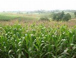
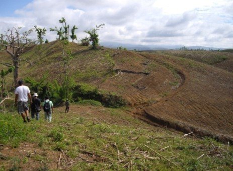
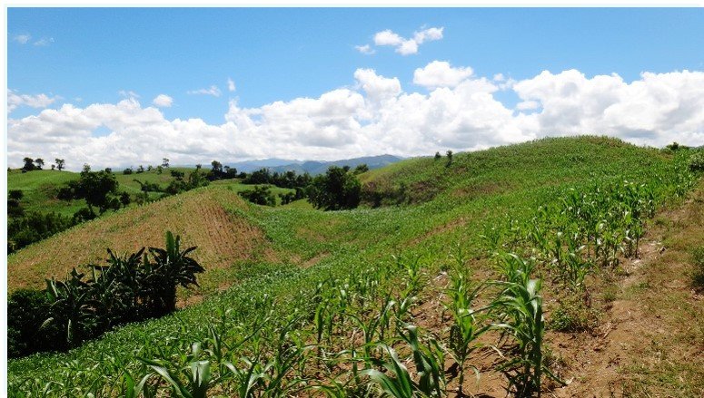
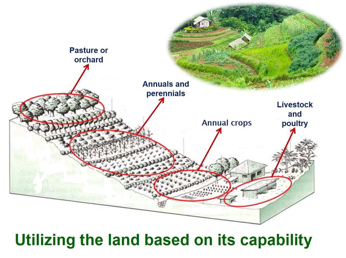
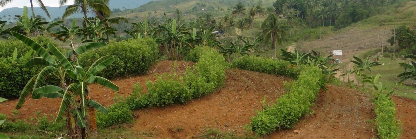
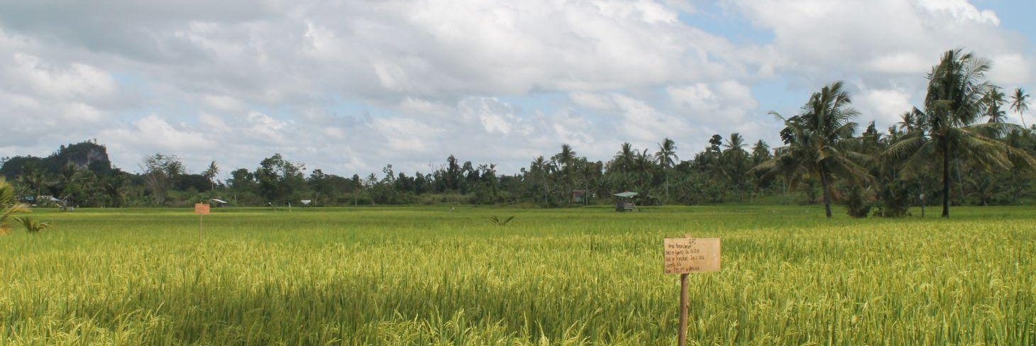
Corn is the second most important crop in the Philippines with about 1/3 of Filipino farmers (about 1.8 million) depending on maize as a major source of livelihood. Corn is generally grown in rainfed lowland, the upland plain, and the rolling-to-hilly agro ecologies. It is the hillyland  areas with slopes ranging from 16-32% where corn is grown that presents the greatest challenge.

The Promotion and Implementation of Sustainable Corn Production in Sloping Areas (SCoPSA) was launched to mainstream SLM in hilly land and

vulnerable corn area in Philippines

highland corn producing areas. The program shall cover corn areas vulnerable to soil erosion in the corn-growing provinces of the country. The aim is to promote a sustainable land use management that will enhance agricultural livelihood and restore ecological balance in sloping areas of the country cultivated with corn.

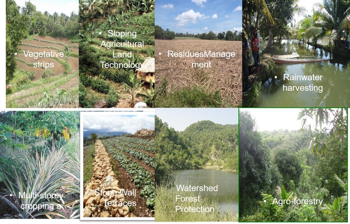
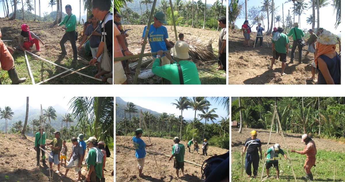
Component 1:  Capacity Enhancement; Training of farmers, agricultural extension workers and other stakeholders in the community to:

  • create awareness on the threats they are facing

enhance their technical capability in handling such problems, particularly on management of sloping areas cultivated to corn.

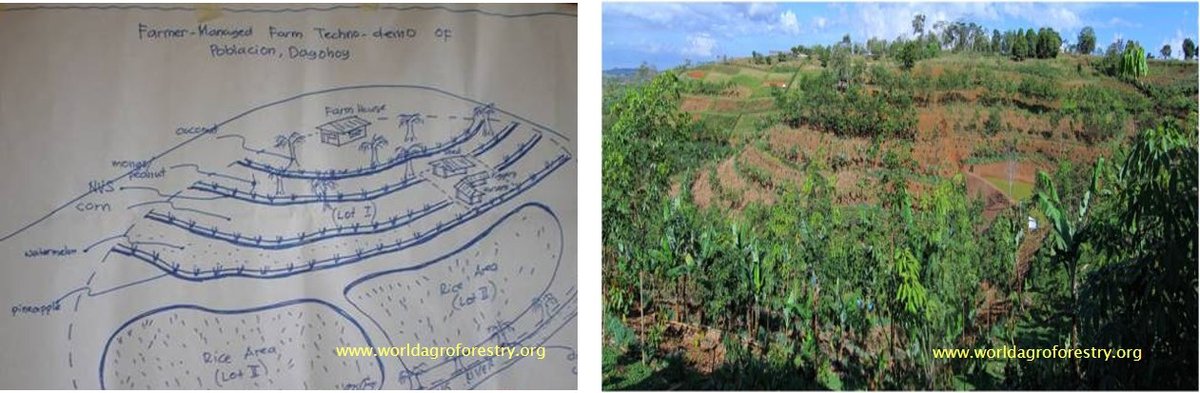
Component 2: Technology Demonstration and Promotion
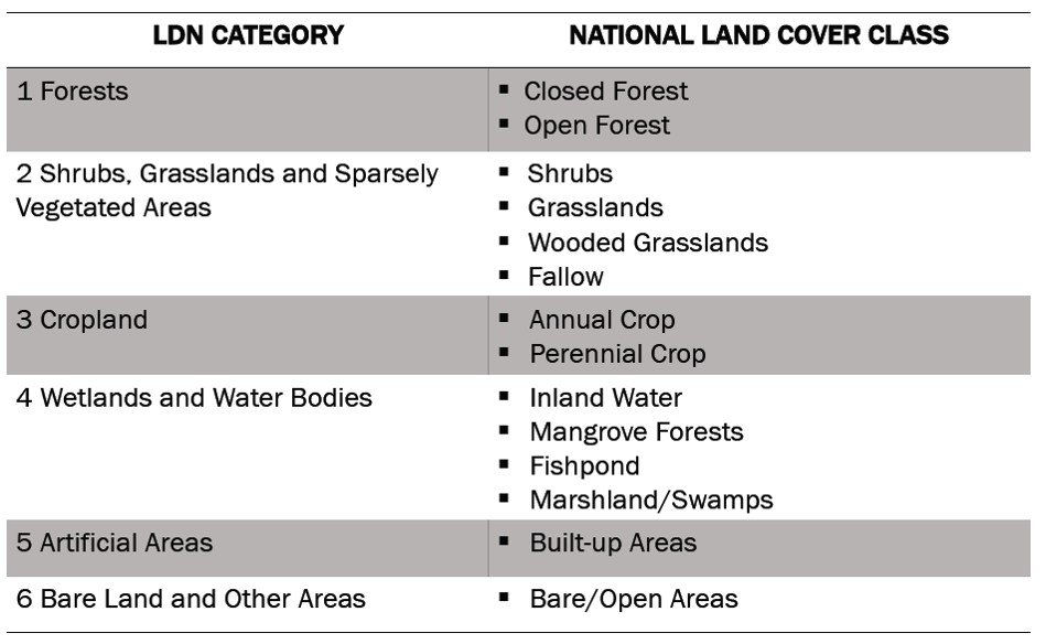
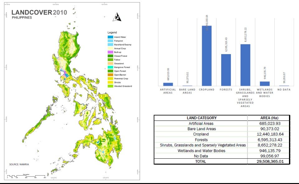
  • establishment of a 3-5 hectare farmer - managed techno-demo farm by DA-RFOs and the Provincial Agricultural Offices in close supervision/assistance by the Bureau of Soils and Water Management (BSWM) in selected corn areas of the country
  • showcase matured technologies or good agricultural practices (GAP) suitable in the bio-physical and socio-economic conditions of the area
  • serve as training centers within the locality

The LUS base map is the land cover map officially released by (NAMRIA).

Following identification of land degradation hot spots based on FAO/LADA-WOCAT mapping tool , priority corn producing provinces were identified for SCoPSA. Priority provinces were Quirino, Isabela and Nueva Vizcaya in Region 2, Iloilo and Capiz provinces in Region 6. Additional provinces were included.


Partnerships with policy institutions and financing mechanisms:

The establishment of techno-demo farms is to be facilitated by the BSWM in partnership with Department of Agriculture-Regional Field Office (DA-RFOs), other DA agencies, LGUs, and partners in the private sector.


Philippines national land cover class
Philippines land cover 2010

.

No / Min-till Philippines

Site selection criteria

1.  Accessible and connected to nearest farm-to-market roads;

2.  Visible to other farmers/farming communities as a show window of soil and water conservation technologies in the locality;

3.  Free from any land tenure conflict;

4.  Preferably, with potential waters sources or sites for water resource development (e.g. SFR);

5.  With the presence of local interest and involvement of local participants particularly corn farmers

With cooperators who are willing to be trained, receptive to new technologies, and have their own resources to continuously pursue the project;


Selection of best SLM practices appropriate for the techno-demo site


Best SLM practices Philippines
Land use according to capabilitiy Philippines

Based on the evaluation of data and information gathered and referring to the Practical Approach for Upland Development as herein presented, a land suitability or land capability map shall be generated.

This map shall serve as a guide for the preparation of land use plan and farm plan for the project. The most suitable land uses (e.g. cropland, pasture land, tree farm, agro-forestry, protected area) will be delineated, identified, and recommended for inclusion in the farm plan. An appropriate cropping system and recommended management strategy for each land use shall also be prepared as part of the plan.

Farm Planning

Step 1:  Establish with the farmers the objectives

Step 2:  Farm resources inventory

Step 3:  Make the farm plan based on appropriate land use

Farm planning Philippines
Training and on-farm planning Philippines

Monitoring and Evaluation:  data to be gathered and generated are as follows:

  • Baseline Information
  • Changes in Soil Properties

1. Before the establishment of the techno-demo farm, soil samples will be collected for  initial analysis.

2. In-situ soil sampling will be done by land facet (top, mid and foot slope) to determine the changes in soil chemical properties, particularly the:

a.  Organic Matter (OM)

b.  Nitrogen (Total-N)

c.  Phosphorous (P)

d. Potassium (K)

  • Pattern of soil movement
  • Economic analysis

Economic analysis will be done among treatments on production cost from labor and other inputs, income (gross and net) and benefit cost-ratio (BCR).

COST AND RETURN ANALYSIS
Farmer partner: Nellie S. Cardenas, Sta. Maria, Maddela, Quirino (2nd cropping 2014 – 2nd cropping 2015)

Source: Municipal Agriculture Office of Maddela, Quirino

Cost and Return Analysis Philippines

The project on compendium of best SLM practices given landscape characteristics is still on-going but on terminal phase.

But the Conservation Approaches and Technologies based on QA and QT are already reported in WOCAT as part of 2016-2017 accomplishments.


Final Report

Publications

For further information on SLM activities in the Philippines visit: