
Land Degradation Neutrality
“Land Degradation Neutrality (LDN)” provides a framework for a balanced approach, which considers trade-offs and anticipates new degradation in order to maintain or enhance the amount of healthy and productive land resources, in line with national development priorities.
- WOCAT - Sustainable Land Management (SLM)
- Land Degradation Neutrality
LDN and the Agenda 2030
Achieving LDN is one of the targets of Sustainable Development Goal (SDG) 15, which promotes “Life on Land”. SDG target 15.3 states: ‘By 2030, combat desertification, restore degraded land and soil, including land affected by desertification, drought and floods, and strive to achieve a land degradation–neutral world’. SDG Indicator 15.3.1 measures the proportion of land that is degraded over total land area.
More information: LDN Scientific Conceptual Framework, SDG 15.3 metadata
WOCAT and LDN
With the new WOCAT 2020+ strategy, WOCAT aims to be a leading and collaborative platform of expertise and a major transformative force in supporting countries and institutions around the world to scale up SLM and achieve LDN.
With the new UNCCD-WOCAT partnership agreement, which was signed in February 2020, and the role and representation in various projects and initiatives, WOCAT and its partners have a say, but also a responsibility in the global LDN discourse. Official UNCCD recognition gives WOCAT the mandate to support the 194 signatory countries in recording their SLM best practices and using the SLM knowledge of stakeholders worldwide – from land users to decision-makers – to improve local land management and achieve LDN.
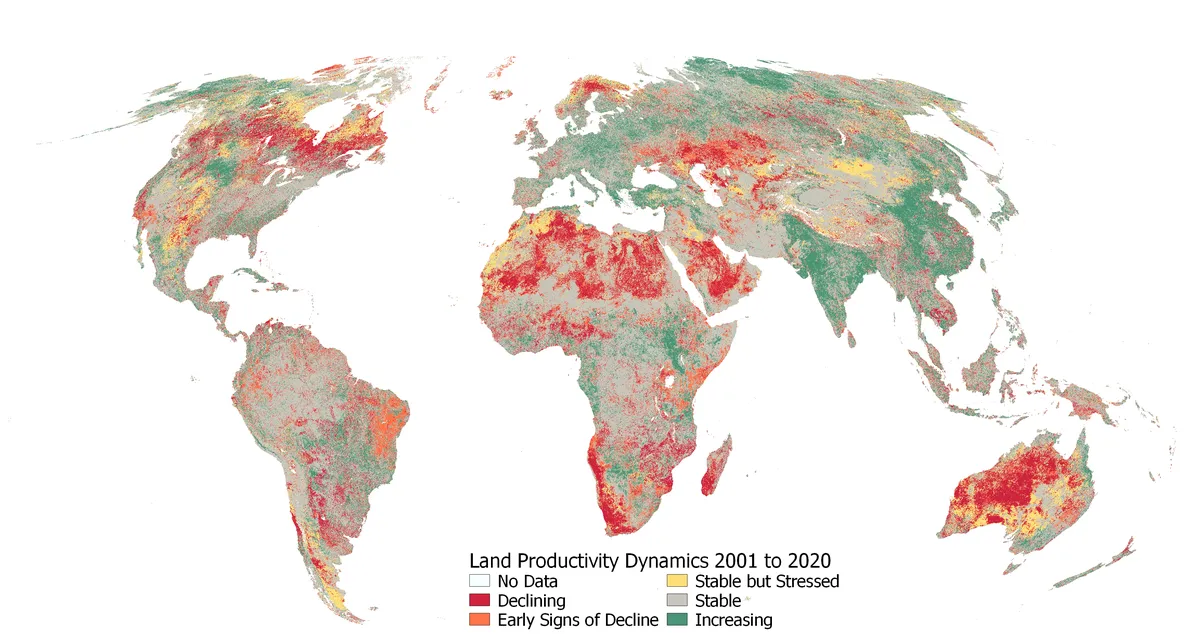
Mapping Land Degradation
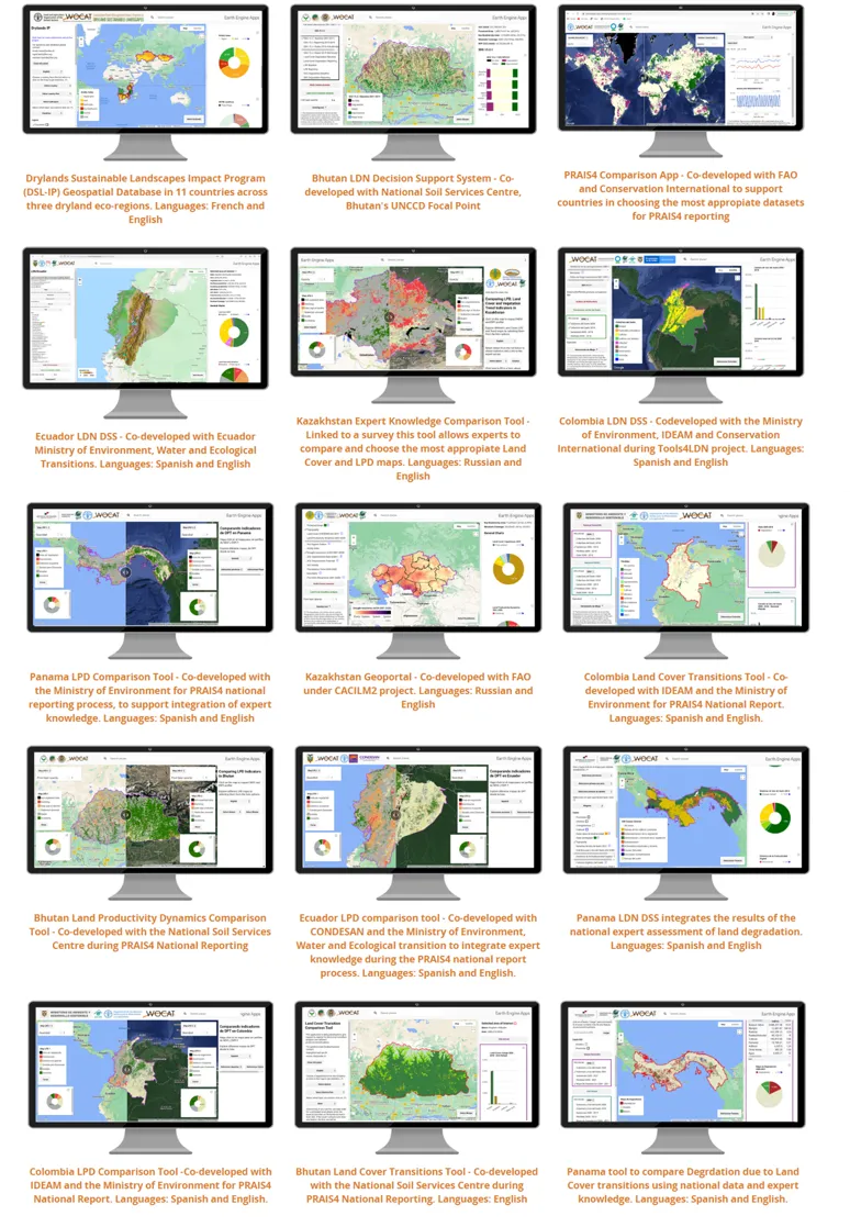
Mapping land degradation is not easy, particularly at large spatial scales. The impacts of land degradation on ecosystem services as well as the drivers and processes involved are spatially diverse and change over time, and so does the social perception of the severity and effects of degradation. Therefore a unique map of land degrdation cannot take into consideration all views or needs. However, mapping and quantifying land degradation is crucial to spatially identify, and strategically plan actions to counterbalance loss of natural capital, as well as to monitor and report progress towards LDN at landscape scale. Using cloud computing WOCAT has co-developed easy to use applications for experts and non experts that integrate global, national and local information. WOCAT Apps facilitate the integration of expert knowledge, support evidence base decision making and planning processes, as well as participatory mapping. WOCAT apps allow users to implement the principle of Convergence of Evidence for mapping Land degradation, as introduced in the World Atlas of Desertification. With just one click you can explore different apps co-developed with various institutions and countries around the world!
Latest LDN related activities
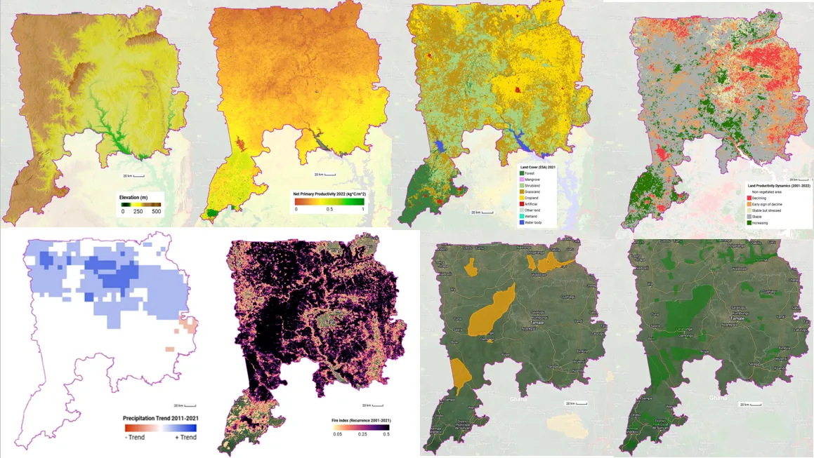
Following the GEO-LDN Global Dialogue Forum, WOCAT is strengthening its support to partner countries by working directly with national GEO LDN teams to translate global commitments on Land Degradation Neutrality (LDN) into practical, country-led solutions. In Ghana, we are supporting a multidisciplinary team to co-develop an LDN Decision Support System (DSS) that places communities at the center of land use planning. The initiative builds on the Community Adaptation Planning (CAP) approach, combining Earth observation and geospatial data with community knowledge to better understand land degradation challenges and identify priority areas for action.
Capacity building, hands-on training, and co-development are the key pillars of this joint work. Through technical mentoring and collaborative design, the Ghana team is being trained to use and adapt the DSS—built on Google Earth Engine—across three ecological zones. The system supports the selection of pilot communities and produces maps that are used in participatory planning processes to link land degradation with impacts on livelihoods, health, and resilience. This follow-up work demonstrates how WOCAT, together with the GEO-LDN Flagship and partners, is supporting countries to move from dialogue to implementation, ensuring that LDN tools are not only technically robust but also locally owned and sustainable.
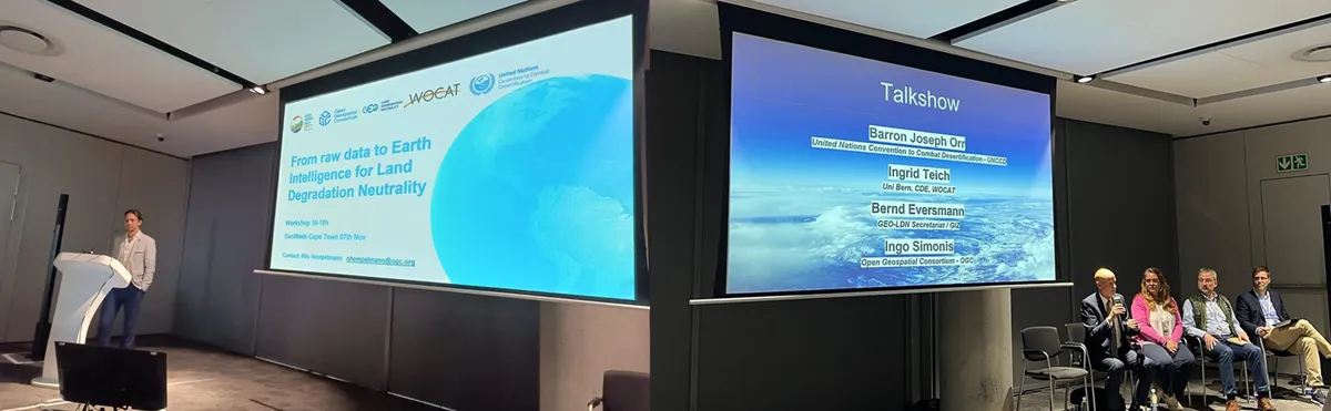
WOCAT participated at the workshop, "From Raw Data to Earth Intelligence in Land Degradation Neutrality", where the focus was on the data pipeline—transforming raw data into usable information and knowledge on demand. The discussions delved into concepts of standardization for analysis-ready data and customization of data. Notably, the workshop underscored the significance of integrating expert and local knowledge, drawing insights from the recently completed UNCCD reporting cycle. WOCAT's contribution brought a valuable user perspective and a reality check to the table, enriching the dialogue on achieving land degradation neutrality through Earth Intelligence.
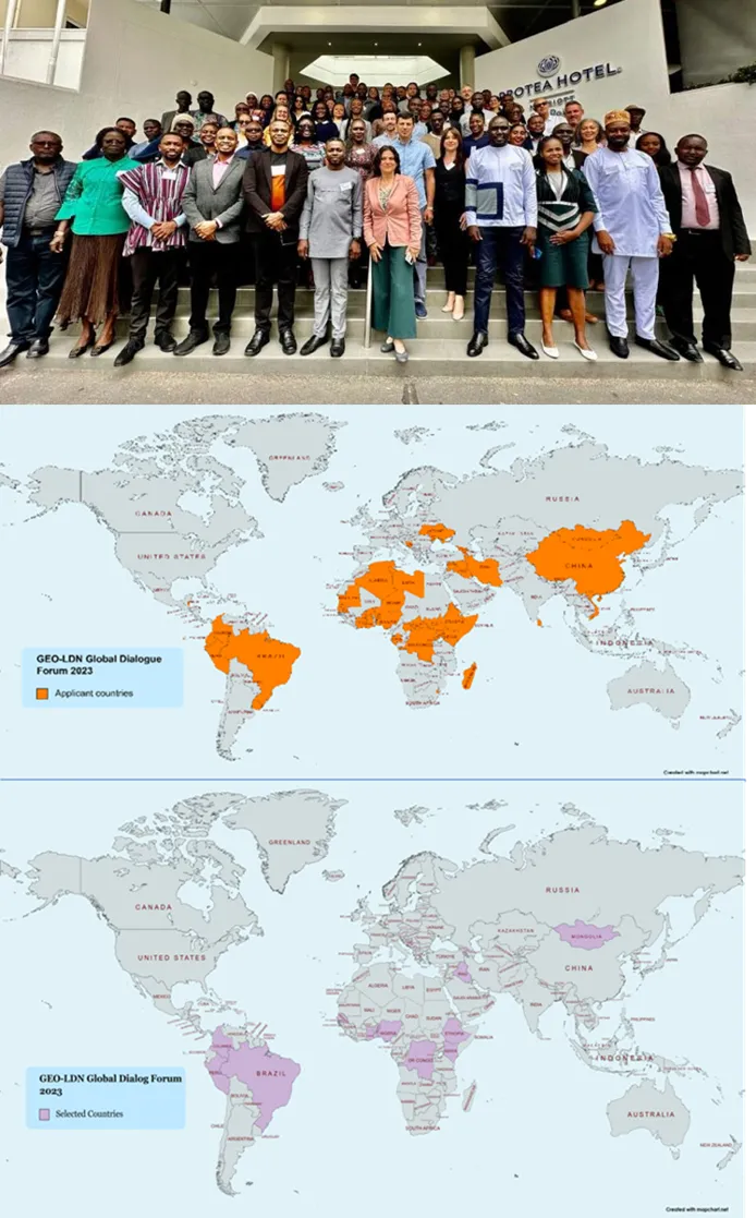
We are thrilled to announce that WOCAT played a pivotal role in supporting the Global Dialogue Forum organized by GEO-LDN. This event, aimed at fostering a collective commitment to achieving Land Degradation Neutrality through the innovative application of Earth observation data and geospatial technologies, witnessed an overwhelming response from around the globe.
WOCAT had the privilege of supporting 14 countries in their quest to contribute to the sustainable management of land resources. In response to GEO-LDN's open call, a total of 59 applications were submitted, representing teams from 40 different countries. The selection process was rigorous, ensuring that chosen teams demonstrated not only a dedication to the cause but also a commitment to inter-sectoral collaboration and gender sensitivity.
The fruitful collaboration between WOCAT and GEO-LDN during the Global Dialogue Forum has yielded remarkable results. The event saw the formulation and graphic representation of 14 impactful use cases during a poster session. Additionally, 14 comprehensive roadmaps for 2024 were developed, outlining strategic pathways for addressing land degradation challenges. The event facilitated direct contacts between GEO-LDN experts and countries, fostering tailored support in areas such as land cover mapping for Armenia, decision support systems for Benin, and higher resolution Land Productivity Dynamics datasets for Belize.
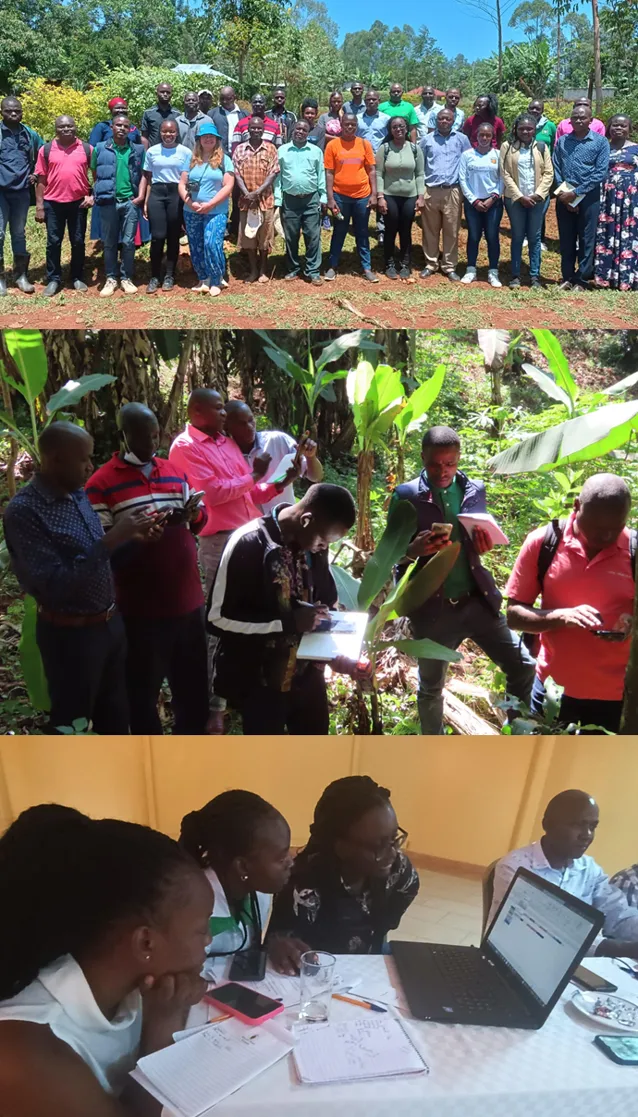
In October 2023, WOCAT and GIZ organized a successful training on Mapping Land Degradation in Kenya in order co develop tools, knowledge products and strengthen capacities to enhance national processes related to UNCCD and LDN, such as reporting and LDN target setting, as well as to support evidence-based processes such as land use planning and monitoring.
We are happy to share that we achieved these outcomes:
- Participants became familiar with the methodology to map Land degradation and estimate SDG indicator 15.3.1 (proportion of land degraded) proposed by UNCCD
- Participants now know how to use Kenya LDN Decision Support System to produce baseline assessments, identify priority areas, and support participatory planning processes.
- Participants are introduced to the use of Google Earth Engine (GEE) and its Code Editor (Java Script) in order to access geospatial datasets and data shared by other users and platforms.
- The most appropriate legend, data source and transition matrix to map degradation due to cover changes in Kenya was identified in a participatory way.
- The most representative map of land productivity dynamics was identified for Kenya based on the analysis of hotspots and greenspots.
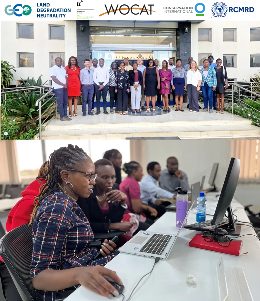
WOCAT tools are part of LDN ToolBox, and we were happy to be part of the GEOLDN training of trainers at the Regional Centre for Mapping of Resources for Development (RCMRD), in Nairobi🌍. Participants of the training have a lot of work ahead in supporting countries monitor LDN and implement ILUP processes that integrate LDN:
- RCMRD experts who will support countries through the Regional Helpdesk. 🛰
- Visiting lecturers of the UNIVERSITY OF ENERGY AND NATURAL RESOURCES-UENR) from Ghana, who are leading the first Postgraduate Programme on LDN 👩🏾🎓
- Fellows of the Global Partnership that will be supporting Nigeria and Ghana for the Capacity Accelerator Network (CAN) 💪🏽
Among other things we worked on:
- WOCAT Apps for Convergence of Evidence
- WOCAT LADA QM
- WOCAT Global SLM database
You can find WOCAT training materials here.
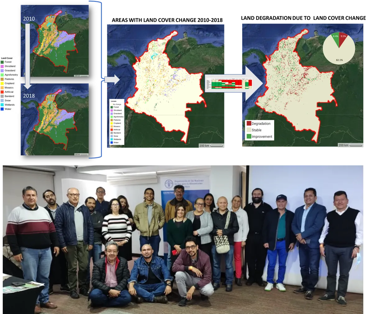
Thanks to the collaborative work of national experts from different institutions together with WOCAT and FAO, Colombia enhanced its national reporting process to UNCCD, shifting from Tier 1 global default data to Tier 3 national data, validated by local experts. A comprehensive legend of 12 land cover classes was defined to assess land cover changes using national maps. These maps enabled experts to evaluate land cover degradation across periods, utilizing a consensus transition matrix. To further facilitate this process, a web-based tool was developed, which you can explore here.
After discussions and negotiations, a consensus was reached during a participatory 3-day workshop held in Bogota in December 2022 Colombia, which united government agencies and civil society from across the country. This event marked a pivotal step in Colombia's journey toward sustainable land management, building upon the GEF-funded Tools4LDN project. As a result Colombia reported to UNCCD reliable estimations of SDG 15.3.1.
The workshop also featured an enlightening discussion on Land Productivity Dynamics (LPD) maps. Participants were introduced to a LPD comparison app, accessible here. Through collaborative assessments and voting, experts selected the most suitable model for their region, ensuring accuracy and relevance. They selected WOCAT-FAO LPD map.
For Soil Organic Carbon (SOC) change, Colombia also used national soil maps on erosion (2011), salinity (2017), and SOC sequestration co-developed with the FAO Global Soil Partnership. As the workshop reached its conclusion, the invaluable insights and data generated were integrated into the national Decision Support System (DSS) established by the Tools4LDN project.
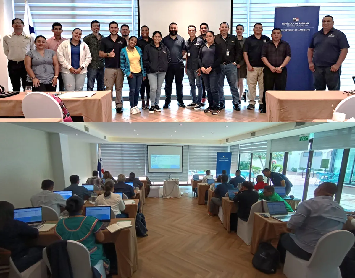
After two virtual sessions and a three-day in-person training in Panama City, a group of young experts from the Ministry of Environment, the Ministry of Agriculture, and indigenous community representatives successfully completed a training program in the use of Google Earth Engine provided by WOCAT and the Ministry of Environment of Panama.
Google Earth Engine is a cloud-based platform that combines satellite imagery and geospatial data for Earth observation and analysis. The platform provides access to petabytes of high-resolution satellite imagery and enables users to perform complex analysis, visualization and monitoring of the land. The platform is constantly updated with new data, making it a valuable resource for combatting land degradation.
The training was an opportunity for the participants to enhance their skills using state-of-the-art technology to address environmental issues, such as mapping and monitoring land degradation. Through a hands-on approach, the participants not only gained a deeper understanding of the capabilities of Google Earth Engine, but also applied it in real-world scenarios. The successful completion of the training shows the commitment of these young experts and the Ministry of Environment to conserving and sustainably managing the environment and natural resources in Panama. Congratulations to all!
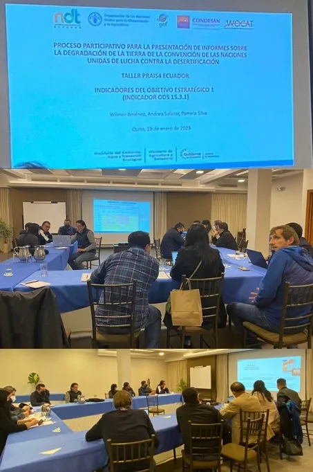
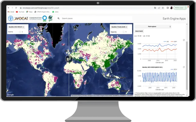
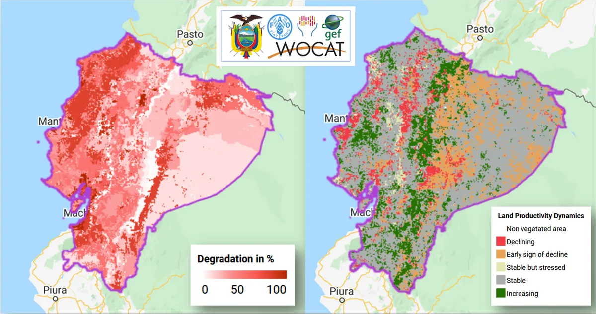
Ecuador is preparing its national report for UNCCD (PRAIS 4 reporting), including SDG indicator 15.3.1, "Proportion of degraded land over total area”. WOCAT has supported the Ministry of Environment of Ecuador to improve its national estimations by integrating national data and expert knowledge and co-developing its national LDN DSS. The LDN DSS is currently being used to map not only hotspots of degradation but also false positives and negatives for PRAIS4 UNCCD reporting.
Experts from WOCAT, FAO, CONDESAN and various national institutions participated in a workshop on January 19th, 2023, and identified ways to improve the mapping of the three land degradation neutrality sub-indicators. This included identifying the most appropriate legend to monitor land degradation due to land cover changes and which transitions led to degradation/improvement. A cloud based tool was developed to explore different land productivity dynamics maps (Ecuador LPD comparison tool).
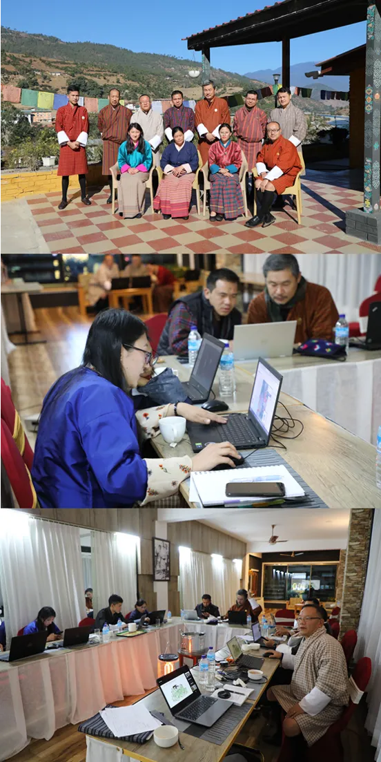
A group of experts from various institutions from Bhutan and WOCAT participated in a national workshop in January 2023 to improve the estimation of SDG indicator 15.3.1 for UNCCD reporting. Even when it is not possible to use national land cover maps, experts explored and compared available data sets and made important decisions in a participatory way, to better monitor land degradation due to land cover changes. They concluded that the 7-category default land cover legend is not enough to monitor one of the country's main land degradation processes: woody encroachment, so the country will add shrublands as a land cover category in the transition analysis. Alternative Land Productivity Maps were thoroughly explored to compare how they differently capture changes in productivity in areas with forest fires, pest infections, timber extraction, mining, overgrazing and settlement development. In general, the FAO-WOCAT LPD map was the most representative one. More exciting work is awaiting ahead to further co-develop the national LDN decision support system and document SLM practices.
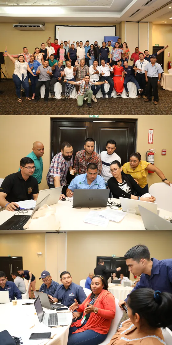
More than 30 territorial experts from different regions, government agencies and aboriginal territories of Panama participated in a workshop co-organized by WOCAT, FAO and the Ministry of Environment to prepare the national report to UNCCD. Building on previous national results, such as the expert assessment of land degradation produced during the GEF funded DS SLM project, and using the national LDN Decision Support System, experts identified and mapped more than 25 hotspots and brightspot, and 30 false positives and false negatives to be inlcuded in Panama PRAIS4 report. National LDN targets were revised with the different government teams and their contributions to each target were registered. The participatory workshop contributed to enhance the enabling environment of Panama to achieve LDN, by building capacities for monitoring LD, identifying gaps and needs and strengthening inter-sectoral collaboration.
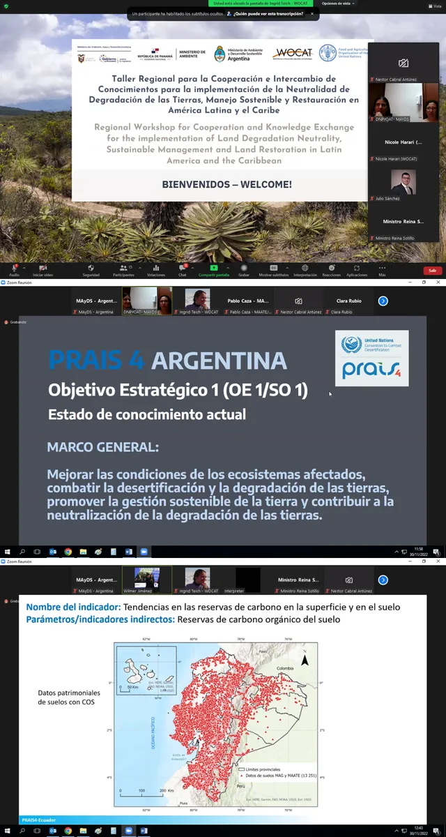
During the final workshop of the DS-SLM project in Ankara (April 2019), the countries emphasized the need to strengthen the exchange of knowledge and capacities, with the support of FAO and WOCAT to continue strengthening South-South cooperation on issues related to Land Degradation Neutrality (LDN), as well as innovative financial mechanisms. Likewise, the importance of South-South Cooperation for knowledge exchange to achieve LDN was emphasized by countries during the UNCCD COP15 in Abidjan.To move forward with a South-South initiative for knowledge exchange on best practices for SLM and land restoration, a series of workshops and consultations with countries are being organized to contribute to the establishment of knowledge exchange networks on Land Degradation Neutrality, Sustainable Management and Restoration.Given the current context, in which countries are preparing their national reports for UNCCD, which includes the estimation of indicator 15.3.1 of the Sustainable Development Goals (SDGs), "Proportion of degraded land over total area”, and given the technical difficulties to map land degradation, we organized a first instance of exchange on the strategies, difficulties and solutions found by countries to map land degradation in a realiable way. Argentina, Ecuador and Panama presented their strategies for PRAIS4 and participants from more than 10 countries of Latin America and the Caribbean exchanged knowledge to capitalize on lessons learned and good practices regarding the development of the PRAIS4 Report for the UNCCD.
One of the main conclusions was that countries need further support to integrate their national data sets and knowledge into PRAIS4 and that projects are a good way to contribute to that goal, which will also guarantee the sustainability of project results. For this to happen it is crucial that the project management units work closely and in coordination with focal points, national institutions and National Action Plans.
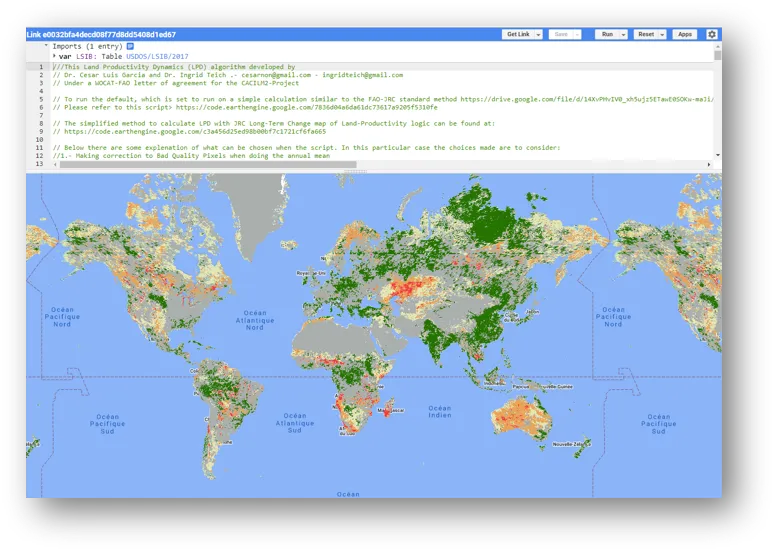
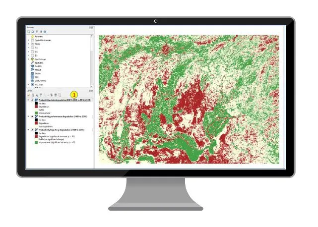
WOCAT collaborated with Conservation International and FAO during Tools4LDN project to develop this easy to use tool where countries can compare the proportion of degraded land (SDG indicator 15.3.1) estimated using different land productivity maps. With just a few clicks the final statistics and maps for baseline and reporting period for any country can be visualized. The default LPD map produced by the Joint Research Center (which is preloaded in PRAIS4 platform), Trends.Earth default LPD and WOCAT-FAO LPD maps can be compared so that countries can choose the most representative one based on their expert knowledge, national assessments and ground-truthing.
Try it at maps.tools4ldn.org !
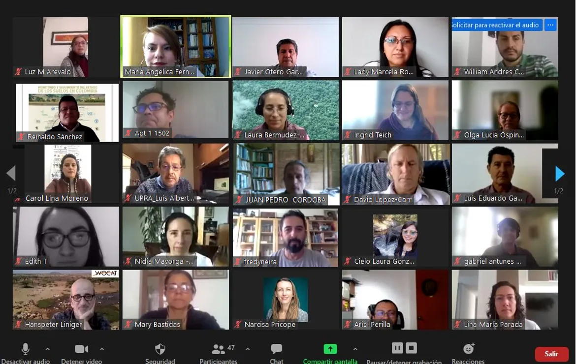
One of the main indicators to map land degradation is the trends in land productivity (SO1-2). It is usually the indicator that accounts for most of the land degradation that is mapped when countries follow the UNCCD SDG 15.3.1 Good Practice Guidance. Therefore, it is crucial to calibrate and verify that the algorithm used for the estimation of the land productivity dynamics map (LPD) reflects the real land productivity trends. In addition to the JRC developed LDP map, which is the one used by default in PRAIS4, countries can obtain alternative LPD maps using Trends.Earth and now they can choose the FAO-WOCAT LPD map within Trends.Earth. Working in different regions of the world and across spatial scales it became evident that many times the available LPD maps did not capture what was happening on the ground in terms of land productivity (see paper). Therefore, building on previous lessons learnt, the FAO-WOCAT teams developed a flexible algorithm and map that is available in Google Earth Engine, for countries and experts to use. During the Tools4LDN project, WOCAT and Conservation International partnered up and made the FAO-WOCAT LPD maps for the baseline and reporting period available in Trends.Earth. Now, countries can easily choose to use it for PRAIS4 reporting when using Trends.Earth!
We are happy to share that the series of 7 workshops and virtual trainings organized with partners from Colombia and Tools4LDN project was a success. Virtual workshops were held in September - November 2021 in Spanish and English to exchange experiences and build capacity on the use of the data and tools integrated in the Tools4LDN project (WOCAT SLM database, Trends.Earth tool, LandPKS mobile application, drought and socioeconomic indicators for LDN reporting). The recordings are available on the Tools4LDN Project YouTube Channel and webpage. As a result we co-developed an LDN decision support webtool to support decision-making and LDN reporting in Colombia that is available in Spanish and English. One of its key functionalities is the multicriteria analysis toolbox that allows to integrate national datasets of soil erosion and salinization with WOCAT SLM database, Trends.Earth SDG 15.3.1 maps and other key layers. We are looking forward to using it during the field verification trip that will take place early 2022.
UNDP and WOCAT want to establish a working relationship towards the further development, testing and implementation of tools and applications related to measuring progress of development projects to address land degradation, conserve biodiversity, and implement sustainable land management practices. This will contribute specifically towards both parties contribution towards Sustainable Development Goal 15 (SDG 15) Life on Land.
The relationship to cooperate and work together originate from a presentation of the GEF 5 SLM Project, managed by UNDP South Africa, on the Sustainable Land Management Progress Calculator (SLM PC), a tool developed by the GEF 5 SLM Project to WOCAT International. Interest has been indicated to add the SLM PC towards the set of tools already developed by WOCAT International to assess land degradation and sustainability, and to describe soil and water management techniques and approaches.
The GEF-7 Drylands Sustainable Landscapes Impact Program (DSL IP) was launched during the Global Landscapes Forum, on 2–3 June 2021. The DSL IP aims at transforming the management of drylands in 11 countries across three geographical clusters; 1) the Miombo and Mopane ecosystems of Southern Africa, 2) the savanna and grasslands in East and West Africa and, 3) the temperate grasslands, savannas and shrublands of Central Asia.. It will also support countries in the implementation of their Land Degradation Neutrality (LDN) Strategies under the United Nations Convention to Combat Desertification (UNCCD).
WOCAT will play a role supporting global, regional and national DSL Knowledge Management activities with focus on durable impact through:
- harmonization and standardization of tools and methods
- open and easy access and use of data and knowledge
- co-development and co-production of knowledge
- equality, trust and ownership in KM processes
From WOCAT we will also work on the Establishment of Communities of Practice to exchange knowledge and experience on Good SLM practices and LDN and regional/ national priority topics among countries experts and implementers.
After a long journey LUP4LDN tool from SCiO, ICARDA, WOCAT, Università degli Studi di Sassari and ELD wins the GEO-LDN Competition and will receive financial and technical support to transform their prototype into an operational and scalable tool.
To achieve Land Degradation Neutrality and monitor land degradation processes, it is key to integrate different sources and types of data at different spatial scales. Participatory expert assessments provide valuable information that cannot be obtained by satellite derived indicators, and vice versa. However, it is still not clear how to integrate expert knowledge and additional national and sub-national indicators into the LDN monitoring process.
To achieve this, we are developing with the Ministry of Environment of Ecuador and FAO a web based geospatial tool that allows users visualize and compare maps, obtain summary statistics of the different types of indicators, and learn about the main recommendations provided by experts for different landscapes in Ecuador.
We are currently working with the results provided by the GEF funded DS SLM project, in which Ecuador carried out a National Level assessment in 2017 using the WOCAT-FAO QM methodology. Different Land use Systems and administrative borders were considered to delimitate a total of 647 landscape units covering the whole country, which were evaluated with the QM by different stakeholders. This offers a great opportunity to integrate expert knowledge with the 3 change of state LDN indicators and other national sources of information.
As part of the Tools4LDN project, we are working on designing the field work campaign in target regions of Colombia to pilot test integration of LandPKS mobile platform with Trends.Earth for verifying biophysical degradation indicators and collection of land management information. To achieve this we are organizing a virtual workshop with national experts and stakeholders to share experiences, current knowledge, tools and data. From WOCAT we are committed to coordinating and supporting the country for successful and meaningful Tools4LDN results.
We are also happy to share that in Trends.Earth there will be new datasets available, such as 10 m resolution maps of NDVI, which can now be visualized on LandPKS. Also, progress has been made on including a WOCAT SLM data base data in LandPKS. We hope soon you will be able to query LandPKS, and according to the field characteristics you enter the system, a list of suggested SLMs will appear. We have also discussed the advantages and disadvantages of using Landsat and Sentinel data to analyse long term NDVI trends and obtaining land productivity dynamics maps, one of LDN indicators. The higher spatial resolution data, such as the one provided by these satellites provides very valuable information to make decisions, especially at field scale. Unfortunately there is a trade-off between spatial and temporal resolution, so for the analysis of long term changes, we still rely of temporal series of MODIS NDVI.
SDG 15.3.1 Good Practice Guidance Addendum
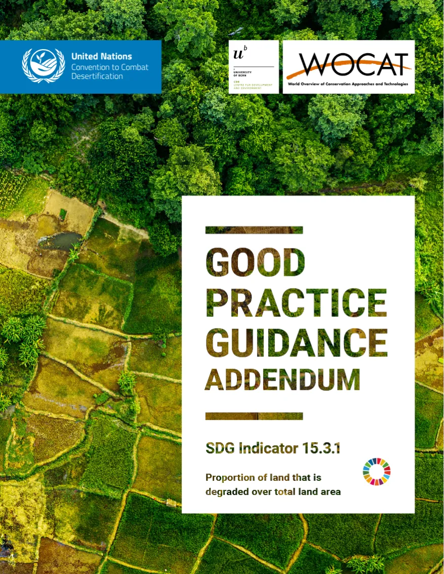
This addendum to the Good Practice Guidance (GPG) for Sustainable Development Goals (SDG) Indicator 15.3.1 provides updated methodological guidance for countries reporting on SDG Indicator 15.3.1 (Proportion of land that is degraded over total land area). The enhancements presented in this addendum aim to improve the reliability, transparency, and relevance of national mapping and reporting on land condition. They also reinforce the broader objective of achieving LDN by 2030, supporting evidence-based decision-making, and enhancing national ownership of data and reporting processes.
View the GPG Addendum here.
To set the ground for efforts on LDN knowledge capitalization and dissemination the WOCAT-LDN Task Force was established in January 2021. The Task Force ensures a regular exchange between WOCAT partners who are working on LDN related projects, databases, tools and applications.
Insights on LDN monitoring and reporting at UNCCD CRIC21 plenary
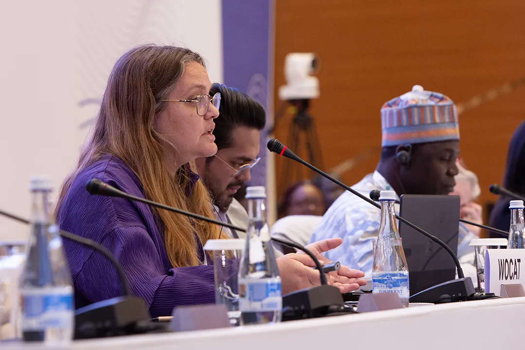
WOCAT's LDN expert Dr. Ingrid Teich shared valuable insights during the UNCCD CRIC21 interactive plenary discussion on 16 November 2023, reflecting on the experiences acquired through WOCAT’s provision of technical assistance for land degradation monitoring and reporting in various pilot countries. Despite time constraints, countries were able to integrate default data with more in-depth analysis, enabling the reclassification of data categories to better reflect local realities.
Check out the presentation here and the video below.
Discover and download the WOCAT LDN training material with presentations on the different tools and methods, and video instructions.
WOCAT has contributed to papers that highlight the relevance of SLM for achieving LDN, the synergies of standardized global methods and tools for assessing and monitoring LDN, and the enabling conditions and environment for the implementation of LDN.