Questionnaire for Mapping Land Degradation and Sustainable Land Management
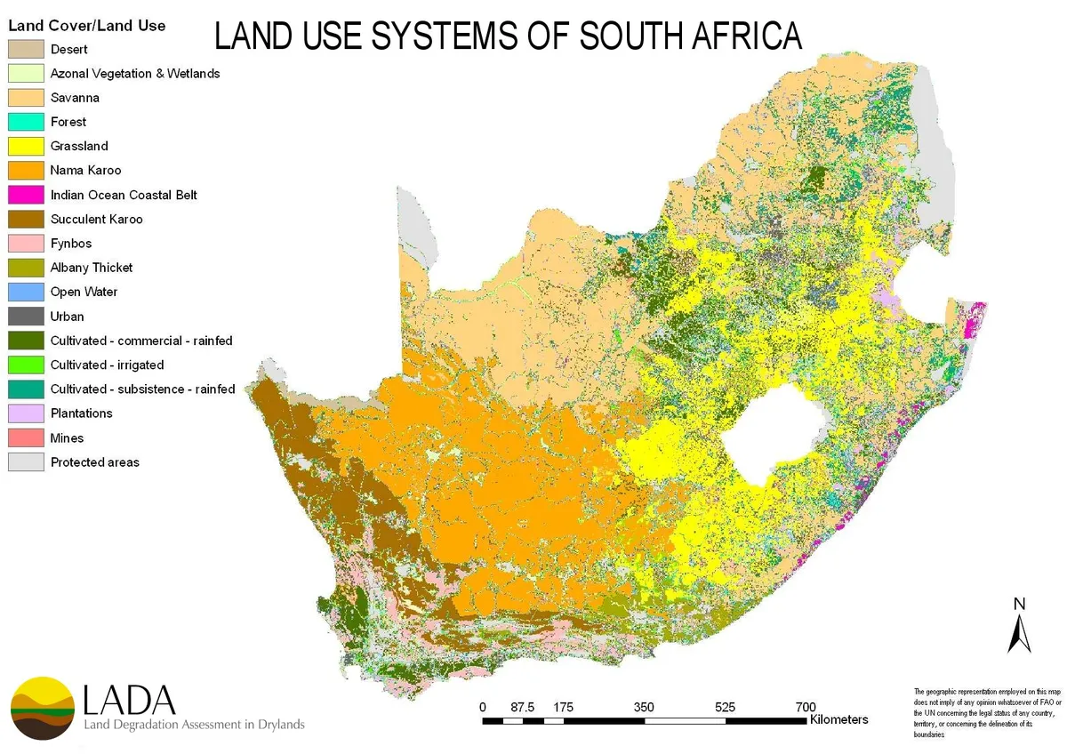
The WOCAT-LADA-DESIRE mapping tool evaluates what type of land degradation is actually happening where and why and what is done about it in terms of Sustainable Land Management (SLM) in the form of a questionnaire completed in an expert assessment. Linking the information obtained through the questionnaire to a Geographical Information System (GIS) permits the production of maps as well as area calculations on various aspects of land degradation and SLM. The map database and mapped outputs provide a powerful tool to obtain an overview of land degradation and SLM in a landscape, country, a region, or world-wide.
This scientific article further elaborates, how the expert assessment can be combined with satellite-driven data in the context of Land Degradation Neutrality (SDG 15.3).
Land degradation assessment in the Argentinean Puna: Comparing expert knowledge with satellite-derived information. César Luis García, Ingrid Teich, Mariano Gonzalez-Roglich, Adolfo Federico Kindgard, Andrés Carlos Ravelo and Hanspeter Liniger. January 2019. Pages 70-80.
https://www.sciencedirect.com/science/article/pii/S1462901118306397
Step-by-Step Guidelines
Word
The mapping database, developed in 2009, is now offline and all documented maps. Here you can find an overview of all data as an excel file documented with the Questionnaire for Mapping from the old mapping database.