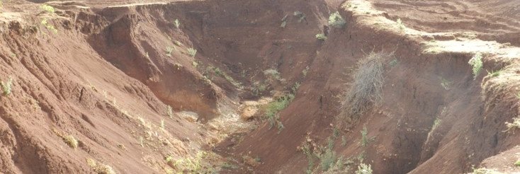
Land degradation is a severe and widespread
environmental problem, and is tackled by the United Nations Convention to
Combat Desertification, the Convention on Biodiversity, and the Kyoto Protocol
on Global Climatic Change. However, there is no authoritative measure of land
degradation and countervailing land improvements. There is pressing need for an
up-to-date, quantitative, and reproducible assessment to support policy
development for food and water security, environmental integrity, international
aid programmes, and national strategies for economic development and resource
conservation.
The Land Degradation Assessment in Drylands project
(LADA) was a five-year project developed by the Food and Agriculture
Organization of the United Nations (FAO), the United Nations Environment
Programme (UNEP), and the Global Environment Facility (GEF). One of its major
tasks was to prepare a Global Land Degradation Assessment map to replace the
outdated GLASOD (Global Assessment of Human-induced Soil Degradation)
evaluation produced by UNEP and the World Data Centre for Soils (ISRIC) in the
early 1990s. LADA ran from 2006 to 2010.
With respect to new developments in monitoring land
degradation, FAO, UNEP, and other partners – including WOCAT – worked towards a
more comprehensive and scientifically based global assessment of land
degradation through the LADA project. LADA was funded by GEF. Among other
objectives, LADA aimed to identify “hot spots” (problem areas) and “bright
spots” (conservation successes). The WOCAT Network and its database and publications
fed into the LADA process by providing numerous examples of these “bright spots”
or “green spots”.
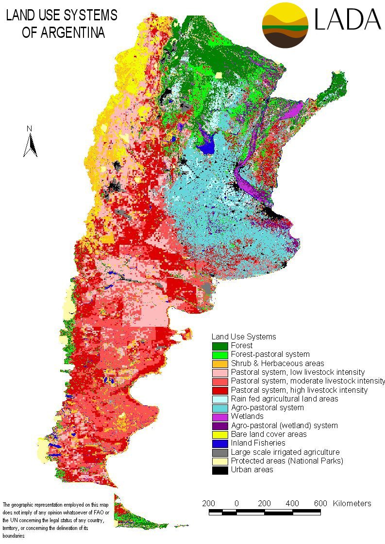
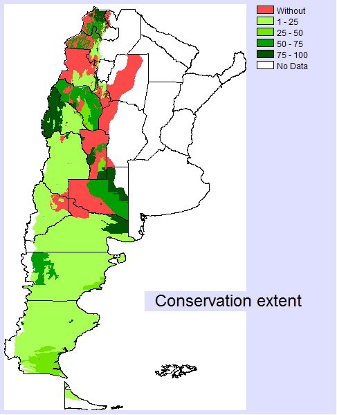
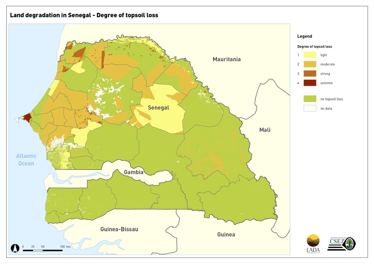
Six countries participated in the project with their
national institutions: Argentina, China, Cuba, Senegal, South Africa, and Tunisia.
Great importance was given to the involvement of stakeholders at all levels,
using participatory approaches, expert consultations, and capacity building. At
the same time, attention was given to international cooperation in combating
degradation. Part of the project strategy was to support the establishment of
regional land degradation training centres in the six countries, and linking
these to the international environmental conventions, UNCCD, UNCBD, and UNFCCC.
The follow-up project to LADA is the Decision Support
in Sustainable Land Management (DS-SLM) project of FAO and GEF.
 Chile
Chile